| |
Although
Uganda is an equatorial country temperatures are not as high
as you might expect. Altitude is an important influence. Much
of the country lies 1,000 metres above sea level. As a landlocked
country, Uganda's network of lakes (rather than the sea) influences
the climate too.
 to
download an Excel spreadsheet of climate data for Kampala,
Uganda's capital city. to
download an Excel spreadsheet of climate data for Kampala,
Uganda's capital city.
The
Rwenzori Mountains, E. Uganda.
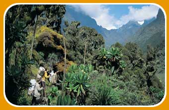 ©Ray
Wood/Panos Pictures.
©Ray
Wood/Panos Pictures.
|
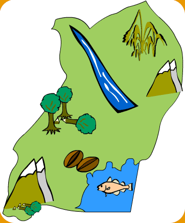
Between
the drier plains of the north and the wetter fertile south,
Uganda has unique ecosystems
like the Rwenzori mountain range. Click on the map to
find out how people use the land, and the pressures they
place on the natural environment in different parts of
the country. |
The
Future
Today, the right to a clean and healthy environment is part
of Ugandan law, and the government is taking action so that
future generations enjoy the same right. The National Environment
Management Authority (NEMA) is responsible for environmental
management in Uganda. NEMA has been successful in making people
more aware of environmental problems, and gives more control
to local people to manage their own environments. But in light
of the vast scale of environmental problems in Uganda more
still needs to be done. Read more about the progress so far
in the Ugandan Environmental Report at http://www.sisei.net/nationaux/uganda/reports/Soe2000.pdf
|
|