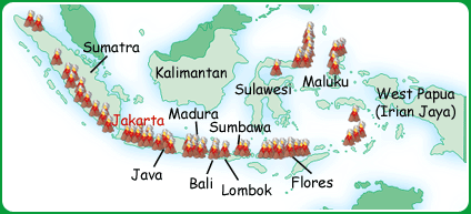
The earthquake that caused the tsunami was one of the biggest ever recorded. But earthquakes are not uncommon in Indonesia. Lying on the Pacific 'ring of fire' on the junction of the Pacific, Australian and Eurasian plates, there is always a high risk of earthquake or volcanic activity.
Click on the icon to open a table of Indonesia's biggest earthquakes since 2001.
- Use the latitude and longitude coordinates to locate them on a map of Indonesia.
- Which islands seem to be most at risk?
- Why is an earthquake on Java likely to cause more concern than one on West Papua or Sulawesi?
|
 |
Since the tsunami, the importance of making buildings more earthquake-resistant has risen to the top of the political agenda. The Indonesian Centre for Earthquake Engineering (CEEDEDS) has produced a manual for builders. It offers guidance on how to make affordable structures that withstand most tremors by adding reinforced concrete or steel frames. Read more about it in the Jakarta Post.
Indonesia has more active volcanoes than any other country - 76 in total. |
 |
 |
|
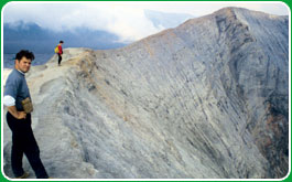 |
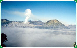
Volcanoes like Mount Bromo in eastern Java are top tourist attractions. Here, tourists walk through the dawn mist on the valley floor before climbing up onto the crater's rim to watch the sun rise and look down into the crater below.
© Simon Scoones/Worldaware |
| Mount Agung on Bali lies dormant, but its previous eruptions have fertilised the surrounding soil. In the shadow of the volcano, Balinese farmers have grown rice on terraced paddy fields for generations. Visit Global Eye Primary Autumn 2004 to find out how these farmers use soil and water wisely to sustain Bali's rice paddies. |
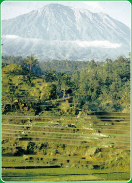
Mount Agung, Bali.
© Simon Scoones/Worldaware |
Other volcanoes erupt without warning and with deadly consequences. The eruption of Krakatau (Krakatoa) on August 27th 1883 caused the most powerful explosion ever recorded, 25 times bigger than a nuclear explosion.  Even Australians heard the explosion over 5,000 km away. Two-thirds of the island collapsed beneath the sea, and it set off tsunamis up to 40 metres high, devastating the coasts of Java and Sumatra. Click on the eye to read an eyewitness report. Even Australians heard the explosion over 5,000 km away. Two-thirds of the island collapsed beneath the sea, and it set off tsunamis up to 40 metres high, devastating the coasts of Java and Sumatra. Click on the eye to read an eyewitness report.
Visit the Channel 4 Science site for more detail and further links on Krakatau's eruption.
Visit the US geological survey site for a more in-depth look at Indonesia's earthquake and volcanic activity.
Visit Volcano World for more images of Indonesia's volcanoes.
|